
Here’s where you’ll find the latest notes & updates about specific springs in the Lower Mainland. If a spring name has no other information listed under it, then there haven’t been any changes since the book was published. This page contains only the current known status; for a history of changes, see the News & Updates page.
March 1, 2020: The Fraser Basin Council public opinion survey has been extended until March 15, 2020. Have your say at https://www.fraserbasin.bc.ca/Hot_Springs_Survey.html .
January 10, 2020: The Ministry of Forests, Lands, Natural Resource Operations & Rural Development is working with the Lil’wat Nation on a Visitor Use Management Strategy for these springs, to address issues & concerns and work together to identify objectives for future recreation management. With recent changing access (i.e. new roads), they’ve seen a relative increase in visitation despite closures.
The Fraser Basin Council has launched a public online survey for this project: https://www.fraserbasin.bc.ca/Hot_Springs_Survey.html . We urge anyone who would like to provide input on the future access and management of these springs to participate. The survey will close on February 28, 2020.
September 28, 2015: The South Lillooet forest service road is washed out at South Creek, according to a BC Government backroads report. An entertaining 1st-
April 5, 2020: Note that under normal circumstances (i.e.: no COVID-
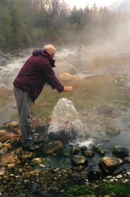
May 11, 2017: According to a posting on the Recreation Sites and Trails BC Facebook page, the Pebble Creek Hot Springs trail is once again closed indefinitely, “due to the presence of at least four aggressive bears in the hot springs area.”
The posting goes on to say that “food and garbage frequently left at the hot springs has taught these bears to obtain food from humans. These bears now directly associate food with people, are behaving aggressively, and are obtaining food from tents, and backpacks. In this type of situation bear attacks are very likely. Help us ensure your safety and the survival of these bears and do not enter the area.”
November 1, 2015: With the ongoing construction of the Upper Lillooet Hydro Project by Innergex Renewable Energy, the old trail to the hot springs has been closed permanently. A new trail, the Liĺwatátkwa7 (Lillooet River) Trail, is now in place. Here are the new access instructions, as of fall 2015. This trip is best when the river levels are low.
From the traffic lights and gas station on Highway 99 just before Pemberton, turn left and drive through Pemberton and up the Pemberton Valley. About 25 km from the junction and gas station, take a right at a sign for Gold Bridge. The road soon crosses the Lillooet River; shortly after the pavement ends. About 7.8 km from the Lillooet River bridge, take the left (lower) fork (the right fork is the Hurley River road). There is a gate just after this junction, generally locked from late fall until springs.
Watch for logging trucks and other industrial traffic on this road, and use headlights. Just after the 37 km sign you enter the hydro construction zone. Stop at the checkpoint booth and sign in (mandatory, no hassles). Shortly after the 42 km sign, there is a small parking area on the right (signposted). Park here.
Cross the road and follow flagging and signs through the active construction zone. The trail drops over the bank, then heads down and upriver to the flats near the river bank. Follow the red markers upriver. It's generally easy to follow; the only place you might have trouble is at one point where you might be tempted to follow the riverbank, but stairs on the right lead up and slightly back. Follow the stairs! From the top of the stairs it's another 10 minutes or so to a new footbridge across Truckwash Creek. In another 5 -
This new trail is longer than the old; the company's notice board claims it's about 1.2 km to the first camping area, but with twists and turns, the distance to the hot springs is closer to 2.0 km. Allow about an hour from the parking lot to the springs and about the same on the way out.
July 25, 2015: The In-